
Featured Work


About Me
Hello, I’m Mohammadmehdi Zare. I am an Urban Planner, Urban Designer, and GIS Specialist passionate about bridging the gap between complex spatial data and sustainable urban design. With a strong foundation in data analysis and 3D visualization, I help transform raw geographical information into actionable strategies and immersive visual experiences. My journey in urban planning has taken me from analyzing land use and infrastructure for master plans in the Middle East to researching natural disaster resilience at the Politecnico di Milano. I specialize in using advanced tools such as ArcGIS Pro, CityEngine, and QGIS to solve spatial problems, while leveraging Twinmotion, SketchUp, and Revit to visually bring those solutions to life. Whether I am coding automation scripts in Python or designing a smart city model, my goal remains the same: to create more resilient, efficient, and livable urban environments through the power of technology
Education
Technical Skills
Work Experience
Urban Planner and Designer
Naghshavand Consultancy Engineering Company
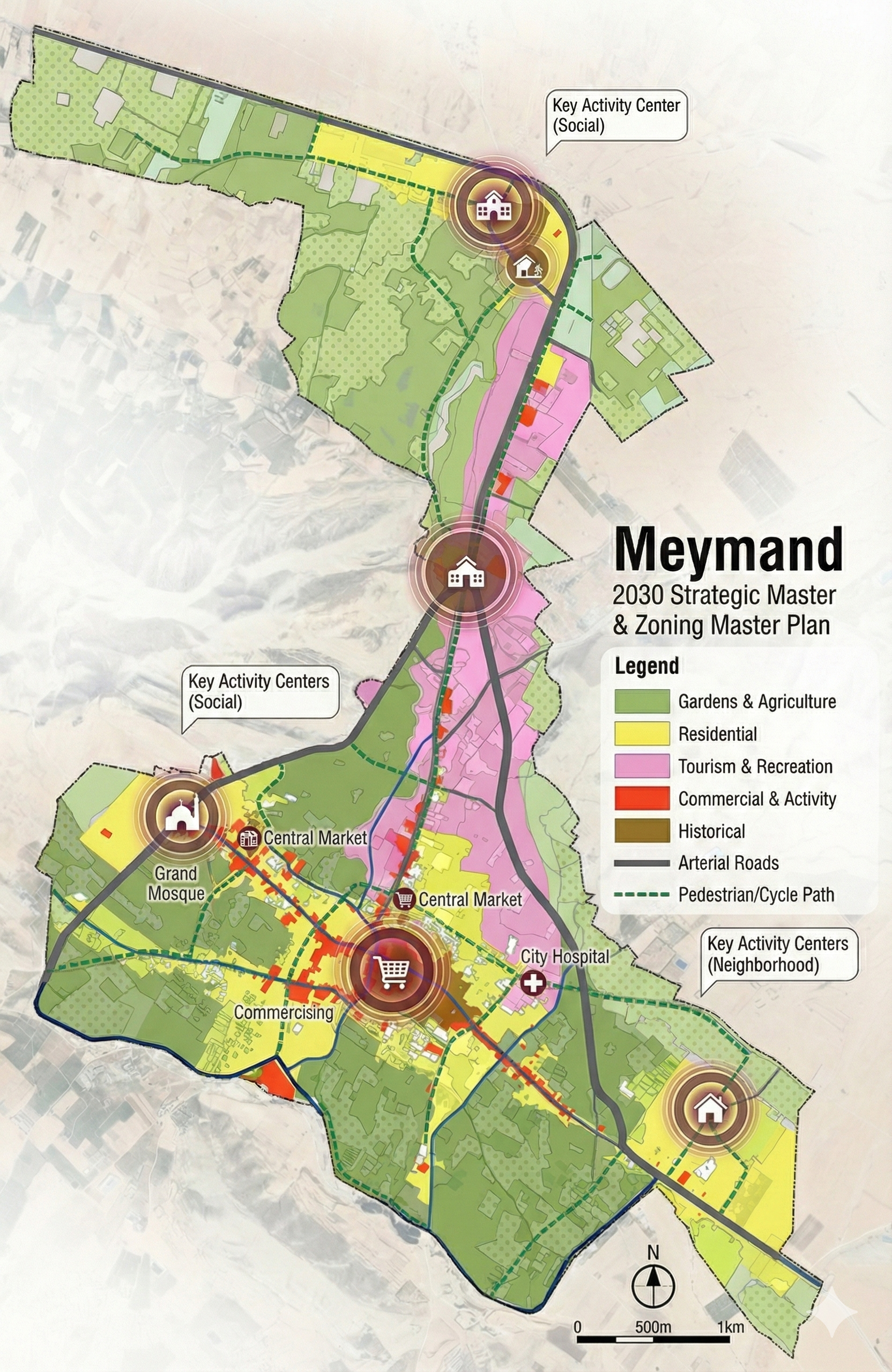
Conducted comprehensive land use planning for Meymand city. Increased allocation of necessary land uses by 25%. Generated comprehensive databases improving data accessibility by 75%. Contributed to Sadra Development Plan optimizing land use strategies.
GIS Expert
Politecnico di Milano (Internship)
Spatializing natural disaster resilience with GIS and geostatistical techniques in Europe. Managed georeferenced data and generated maps reflecting disaster intensity.
Teaching GIS and Civil3D
Apadana University
Teaching Civil 3D software to students.
GIS Specialist
Parsboom Consulting Engineers
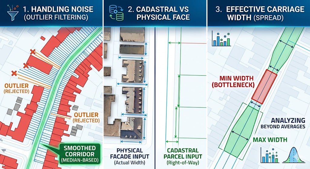
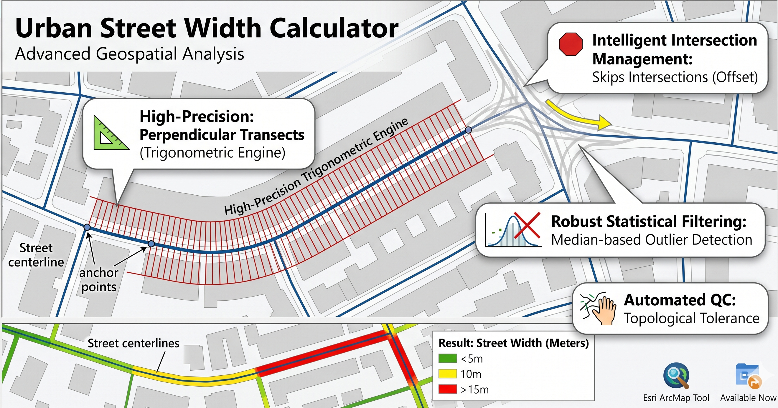
Participation in initial phase of identifying study area. Comprehensive evaluation from urban planning perspective. Analysis of land use, infrastructure, and transportation.
Latest Articles
Let's Work Together
Have a project in mind? I'm always open to discussing new opportunities and ideas.
Mohammadmehdi.zarechogiyaee@mail.polimi.it